LARIG - Surveying and Geomatics Laboratory
Gallery
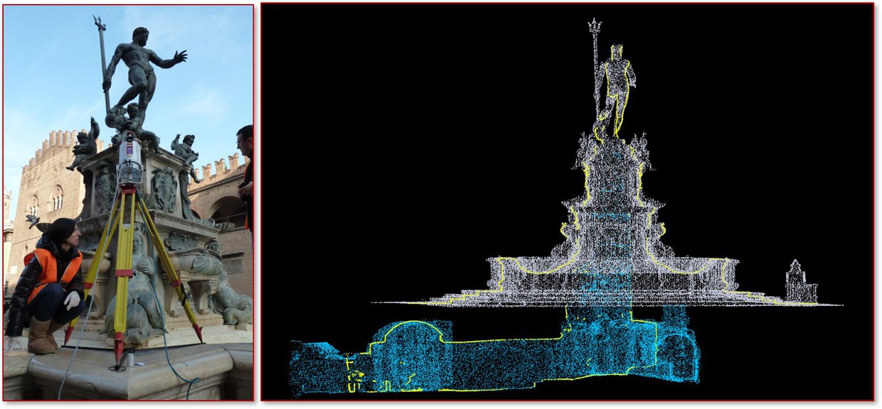
Terrestrial laser scanner survey of the Nettuno Fountain and underground, Bologna, Italy
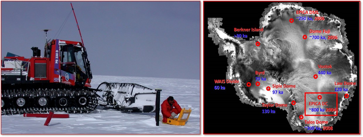
Geodetic surveys in Antarctica for Glaciology and Paleoclimate projects
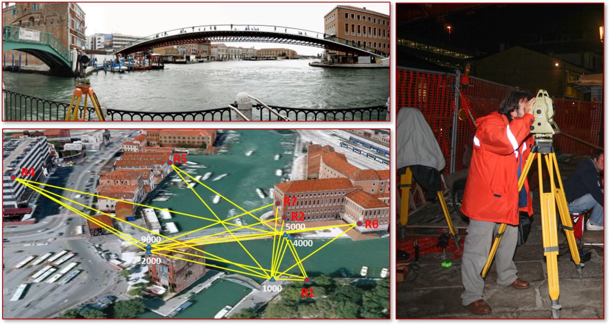
Topographical network for the control of structures, Costituzione Bridge in Venice, Italy
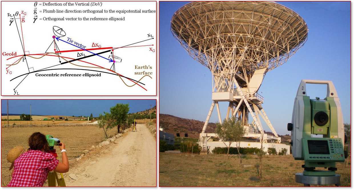
Topographical surveys to support the definition of international reference frames, Noto (Siracusa, Italy)
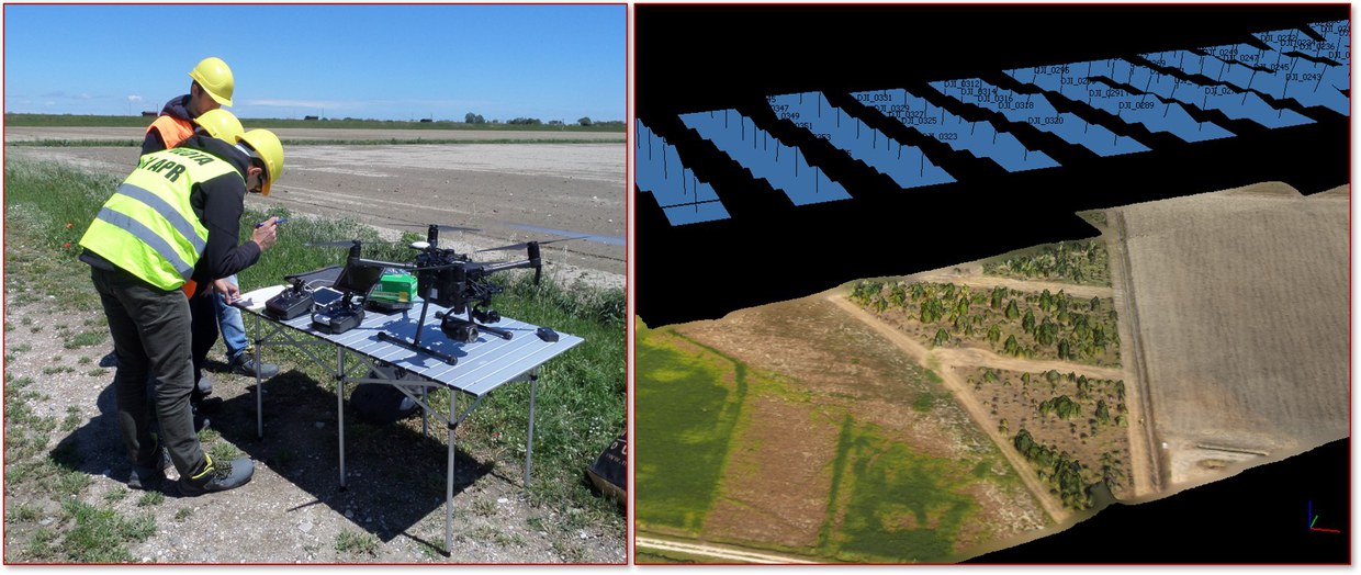
Aerophotogrammetry from RPAS with visible and thermal sensors for agricultural applications, Ravenna, Italy
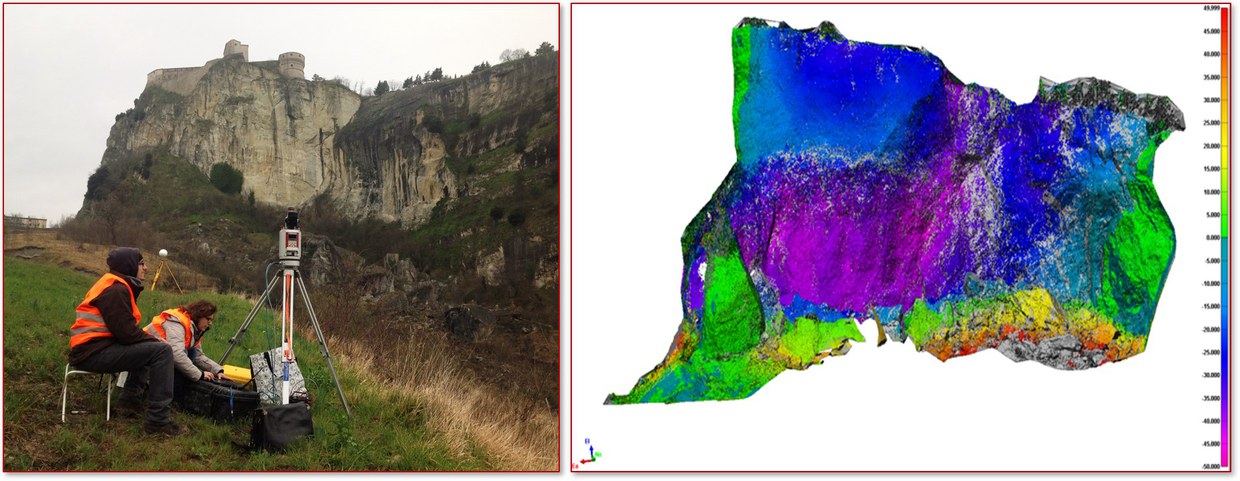
Terrestrial laser scanner survey for stability analysis of rocky bodies, San Leo (Rimini, Italy)
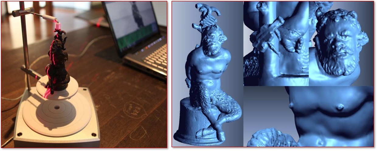
High precision three-dimensional survey of museum objects
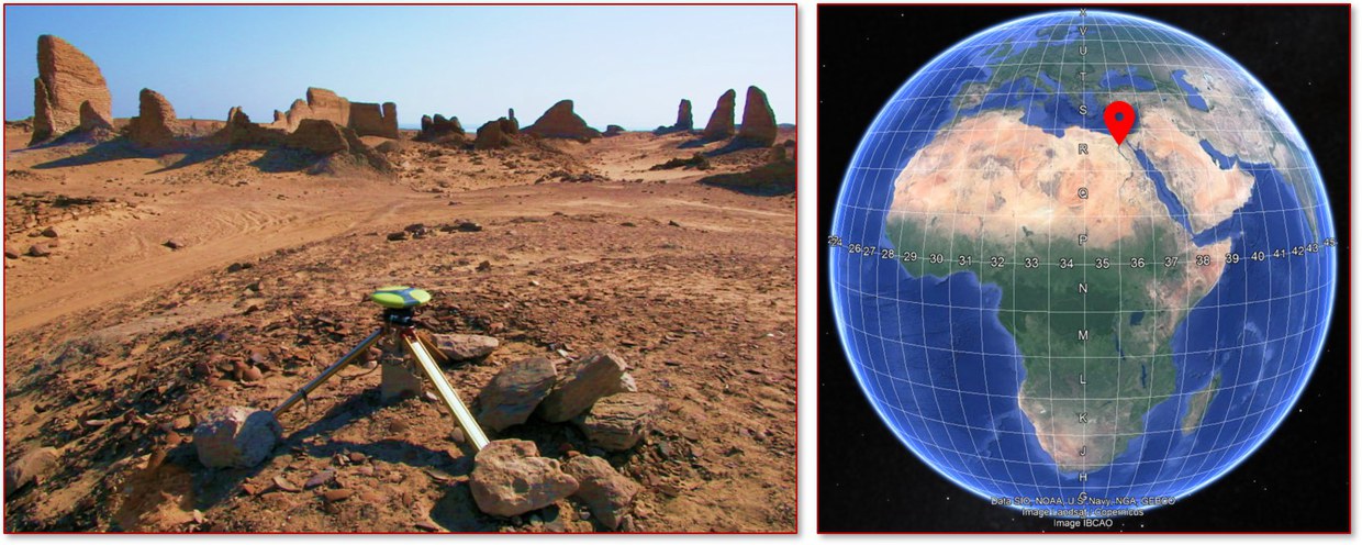
Integrated geomatic surveys to support archaeological campaigns
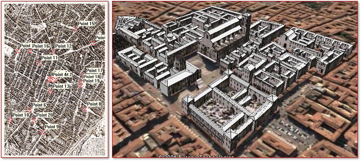
Virtual reconstruction from historical cartography
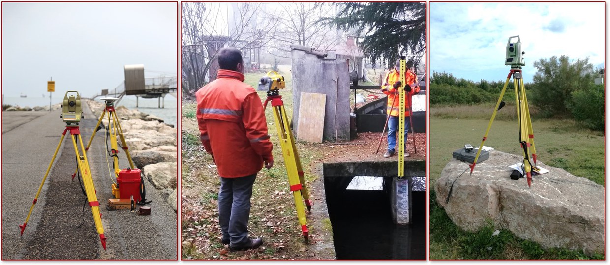
High precision surveys for altimetric monitoring
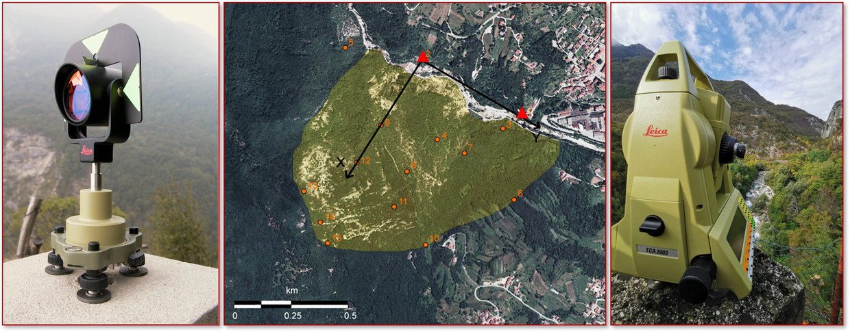
Three-dimensional network for monitoring landslides, Landslide of Brustolè (Vicenza, Italy)
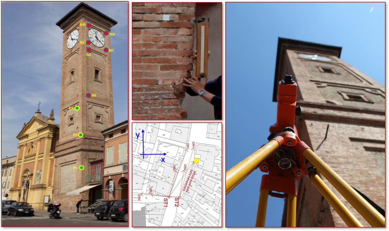
Integrated topographic system for the monitoring of buildings with prevailing vertical development, leaning bell tower of San Matteo Church in Molinella (Bologna, Italy)
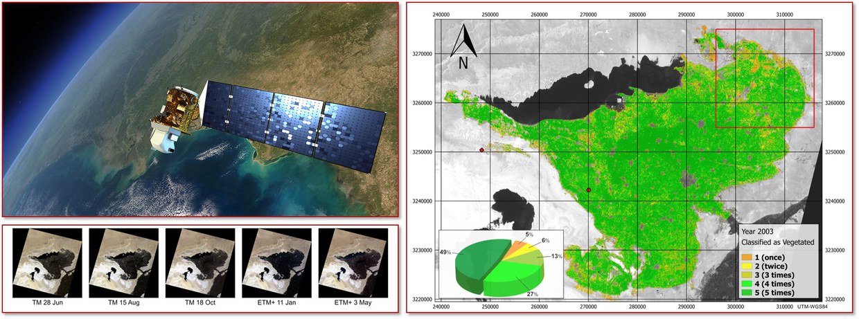
Extraction of thematic maps from satellite images for monitoring the territory
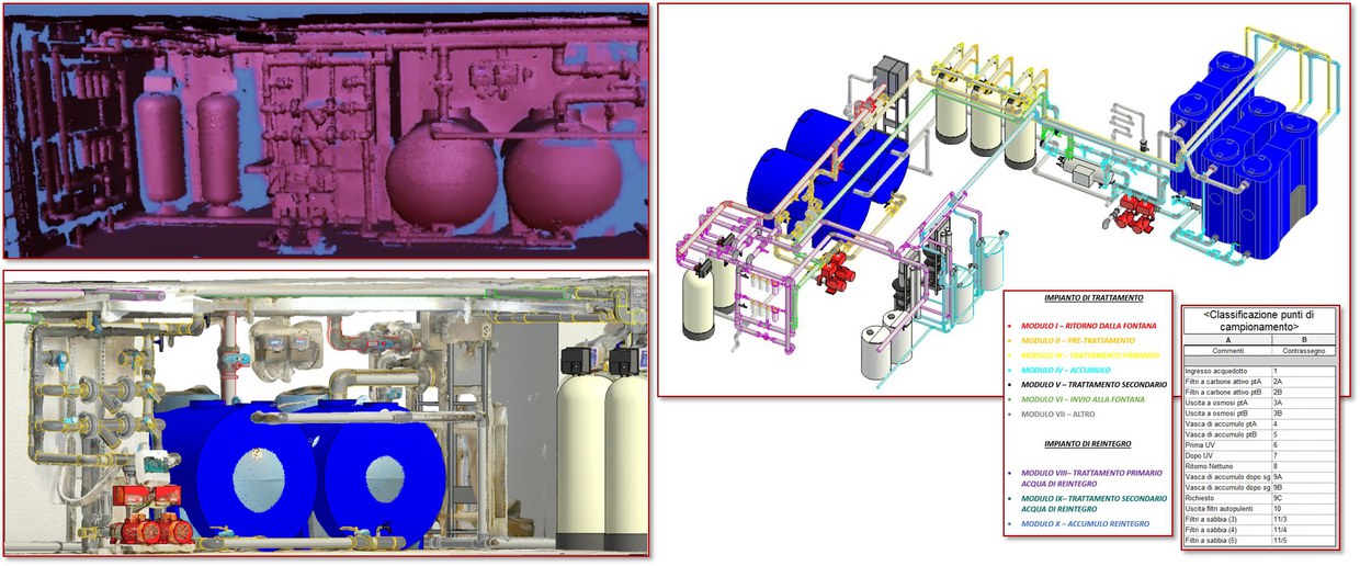
3D surveying and modelling of industrial plants
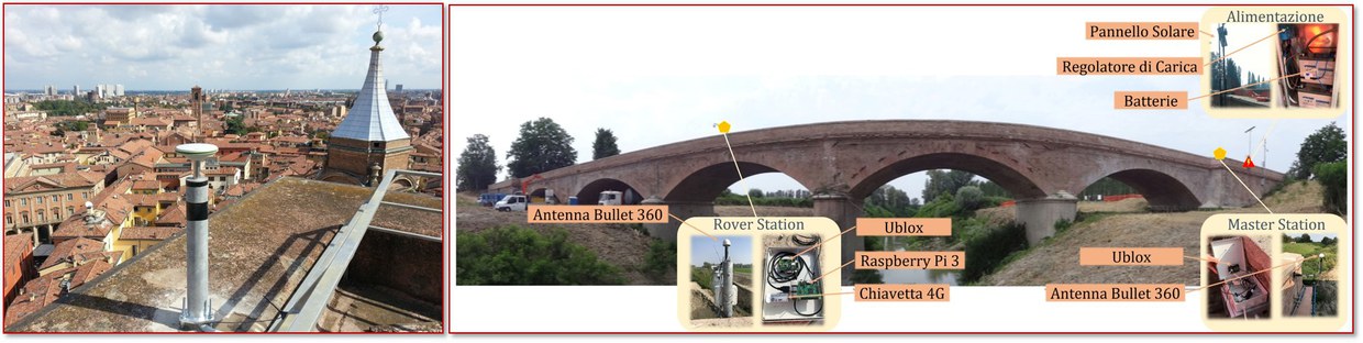
GNSS monitoring systems for structures and territorial infrastructures
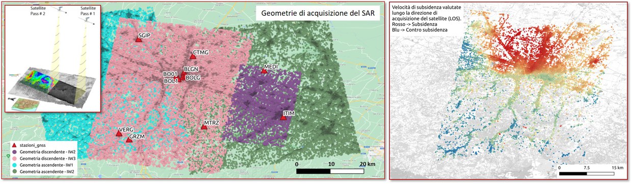
Analysis of ground movements using SAR interferometry
The Surveying and Geomatics Laboratory of the DICAM (LARIG) supports research and didactics in the field of Geomatics, and carries out activities of geospatial data collection and analysis, providing also technical-scientific consultancy for third parties.
The LARIG includes the technical, scientific and didactic expertise that characterize the Topography and Geomatics Area of the DICAM Department. The Laboratory is involved in many activities of design, implementation and analysis of geodetic, topographical, photogrammetric, 3D scanning and remote sensing. The laboratory has a rich and up-to-date equipment for field surveying and a section dedicated to design, analysis and data processing.
History
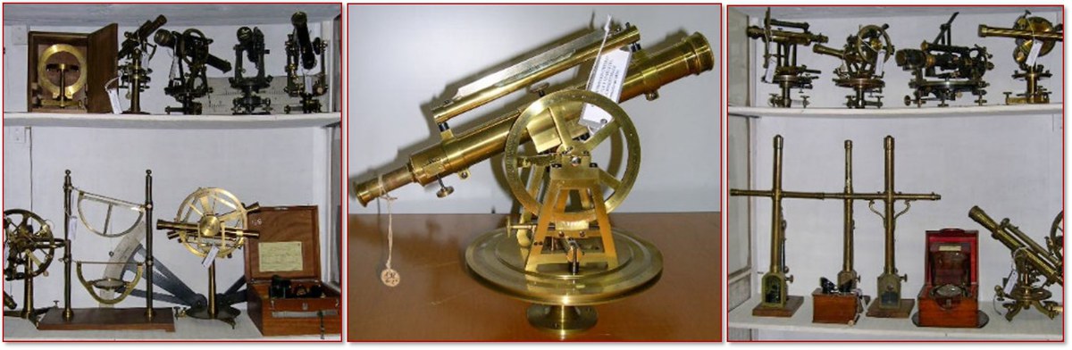
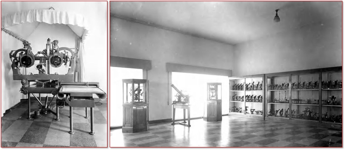
The Laboratory was born in 1935, at the same time as the Faculty of Engineering. Equipped with a large instrumental park, it inherited also the instrumental heritage formerly belonging to other faculties of the University of Bologna and now preserves a valuable collection of historical topographic instruments.
Many of these instruments come from the Practical Geometry Cabinet of the Regia Scuola di Ingegneria in Bologna, born in 1877. The Cabinet was equipped by Prof. Pietro Ricciardi, then Professor and Director of the School: many instruments were purchased from the main manufacturers of the time (T. Ertel and son of Munich, Troughton and Simms of London, Starke and Kammerer of Vienna, La Filotecnica and Tecnomasio of Milan).
In 1935 the Regia Scuola di Ingegneria became the Faculty of Engineering and moved from the old seat of Piazza dei Celestini to the new one of Viale del Risorgimento 2, designed by the architect Giovanni Vaccaro. The roof of the library tower of the School, a tribute to the medieval tower buildings of Bologna, was designed as a terrace to be used as a Geodetic Observatory; still there is a geodetic point of reference. The new system of engineering studies, which came into force in that year, provided for two sections: civil and industrial. The Institute of Topography and Geodesy with its Laboratory was born.
Reasearch topics
Thanks to decades of experience and the wide availability of specialized hardware and software tools, LARIG is able to support research in the fields of:
- development and analysis of GNSS and terrestrial geodetic infrastructures, framed in International Reference Systems,
- GNSS networks for real-time satellite positioning,
- design, implementation and analysis of geodetic networks for high-precision monitoring of soil and structure movements,
- photogrammetric surveys by terrestrial, aerial (also from RPAS) and satellite images,
- 3D scanning techniques using TOF laser scanners, triangulation scanners and structured light projection scanners,
- multi-scale and multi-temporal analyses of satellite and aerial imagery, encompassing multi/hyper-spectral sensors and SAR,
- integration of different methodologies in interdisciplinary fields: GNSS-DInSAR-Levelling for the study of vertical ground movements; inertial, acoustic and surface GNSS sensors in underwater surveying; GNSS-GPR integration for geophysical exploration in the archaeological and glaciological field, etc.
- survey of Cultural, Architectural and Archaeological Heritage with integrated geomatics techniques
- implementation of GIS solutions
Teaching and Training Activities
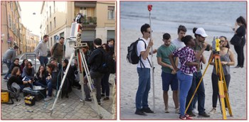
LARIG offers its resources to support exercises for bachelor and master’s degree courses related to geomatics (Topography, Photogrammetry, Remote Sensing and GIS, Monitoring Networks, etc.), allowing students to use first-hand specialist equipment for both survey and data processing.
The experimental activities carried out in LARIG allow the development of bachelor and master’s degree theses, support research projects of Phd students and postdoctoral students and curricular internship and/or preparatory to the thesis.
Services and consulting
The LARIG carries out consultancy for industrial innovation needs and carries out activities in collaboration with the CIRI Building and Construction (Tecnopolo di Bologna).
Instrumentation available to the laboratory
High precision robotic total stations and accessories for buildings and structures
High precision analog and digital auto-levels equipped with INVAR rods
Multi-frequency GNSS receivers for permanent station installation and real-time positioning (RTK and NRTK)
Terrestrial laser scanner systems based on time of flight, triangulation and structured light projection technologies
Photogrammetric scanner for aerial frames
High resolution thermal camera
Different types of RPAS systems
Spectroradiometer
High performance workstations for:
- Processing of large photogrammetric blocks and Structure from Motion solutions
- Point cloud processing and high resolution three-dimensional data modelling
- Analysis of GNSS data of intercontinental networks and time series through the three main scientific software (Bernese GNSS, GipsyX, GAMIT/GLOBK)
- Analysis and classification of satellite images and SAR interferometry
- Geospatial data management in GIS
Contact
|
Scientific contact Prof. Luca Vittuari |
Technical contacts Chiara Bonini, PhD Ing. Maria Alessandra Tini, PhD |